
Madison County Neighbors by Source
A block lookup needs several record layers. The GIS map shows how parcels touch. DEVNET supplies the assessment entry for each selected parcel. Recorded plats explain the legal block. Voter information has a narrow civic-use frame, while Edwardsville’s association program describes voluntary community boundaries. These sources describe different groups, so one row cannot stand in for another.
Use the access column before searching. Madison County has useful public portals, but it does not publish a single countywide list of neighbors or associations.
| Source | What it shows about a block | Access |
|---|---|---|
| County GIS viewer | Adjacent parcel shapes, parcel relationships, and map position | Free public viewer; exact live tools can change |
| DEVNET property roll | Owner, PIN, situs, mailing, assessment, sale, class, and district clues | Free public search |
| Recorder plats | Subdivision, lot, block, easement, right-of-way, legal description | Tapestry after 1984; vault and copies for older material |
| County voter tools | Permitted registration and precinct or district information | Election Code restrictions apply |
| Edwardsville associations | Recognized civic boundaries and published contacts | City program, not a resident roster |
| Municipal archives | Minutes, ordinances, projects, site plans, and notices | Archive search or city FOIA |
Map Madison County Neighbors Outward
The Madison County GIS Viewer is a map aid. The inspected text did not expose exact layer names, popup fields, or a verified buffer tool, so rely on ordinary parcel identification and map browsing rather than a promised radius feature. Keep the known address and its parcel number beside the map.
- Find the subject address or PIN in DEVNET and save the exact situs string.
- Open the GIS map, locate that parcel, and note the parcels that touch or face it.
- Copy each adjacent PIN into DEVNET one at a time.
- Compare each situs, owner, mailing field, tax year, and sale clue.
- Use a Recorder plat when the legal block or shared boundary is unclear.
This process identifies assessment owners around a block. It does not identify every occupant. For an entire road instead of the near parcel ring, use the Madison County directory by street.
Check Madison County Adjacent Parcels
DEVNET wEdge accepts a parcel number, owner name, house-number range, street name, city, mailing address, sale range, document number, tax district, class, township, land use, and tax year. For neighbors, the PIN is the cleanest handoff from the map. A street range can help, but it may return parcels beyond the immediate block.
The situs is the property location. The mailing address is where assessment mail goes. A distant mailing address may reflect an estate, entity, or owner elsewhere, not a vacant house and not the location of current residents. Homestead or exemption data can be a clue, but it should not be rewritten as a firm occupancy statement.
Record the portal’s update date with the results. The public page warns that its information is not warranted as an official determination, so a disputed owner or boundary belongs with the Chief County Assessment Office or Recorder.
Insider tip. Use one PIN per row so owners, situs addresses, mailing fields, and deed clues never slide onto the wrong parcel.
Plats Define Madison County Blocks
A ZIP code, mailing city, or informal neighborhood name cannot define a legal block. A recorded subdivision plat shows lots, blocks, easements, rights-of-way, and survey relationships. The Madison County land-search page routes later instruments to Tapestry, while older plats and deed books may require the Recorder counter, vault, email, or mail.
Search with the parcel number, subdivision name, lot, or block captured from DEVNET or a deed. Rural land may use section, township, range, and quarter-section terms instead. Those are metes-and-bounds or survey clues, not street numbers. A plat can explain which parcels truly adjoin even when their postal labels differ.
County 9-1-1 addressing was approved in 1989 and operational in 1992. Historic directories and ordinances may use an older number or name. Save the current postal string separately from the legal description.
Madison County Voters on a Block
Madison County provides Voter Search, voter lists by district, township, or precinct, and an election-history database. Exported voter-list fields can include name, street components, city, ZIP, township, precinct, districts, and limited voting-history codes. A registered voter is not the same as every person at an address, and a list reflects its download date.
Illinois Election Code limits these tools to the stated lawful election purpose and protects fields such as phone number, Social Security number, birth date, email, and parts of address data under applicable rules. Do not turn a permitted civic file into an unrestricted neighbor roster. A missing person may have moved, changed a name, become inactive, fallen outside the chosen precinct, or hold protected status.
The Madison County Election History interface is useful for contests, candidates, questions, voters, documents, and past totals, but it is not a live household list.
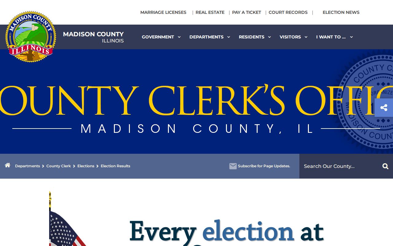
The separate history tool adds civic context without proving who currently occupies any nearby parcel.
Edwardsville Connects Local Neighbors
Edwardsville’s Neighborhood Associations program is the clearest official community layer found in Madison County. The voluntary program was approved in June 2016. It is distinct from a formal property-owner association and does not publish a complete list of member households.
The city application asks for an association name, primary and alternate contacts, year organized, current officers, boundaries, major cross streets, ward or alderman, and counts of single-family, multifamily, commercial, and vacant lots. It also asks about schools, churches, recreation centers, bylaws, and key issues. Those fields can define a civic area around an address without naming everyone who lives there.
| Boundary clue | Community use |
|---|---|
| North, south, east, west limits and map | Places the block inside a stated association area |
| Cross streets and ward | Connects the area to city geography and notices |
| Published contacts and officers | Identifies civic contacts, not all residents |
| Schools, parks, churches, and lot counts | Describes the area served |
Review the city association page for the current program.
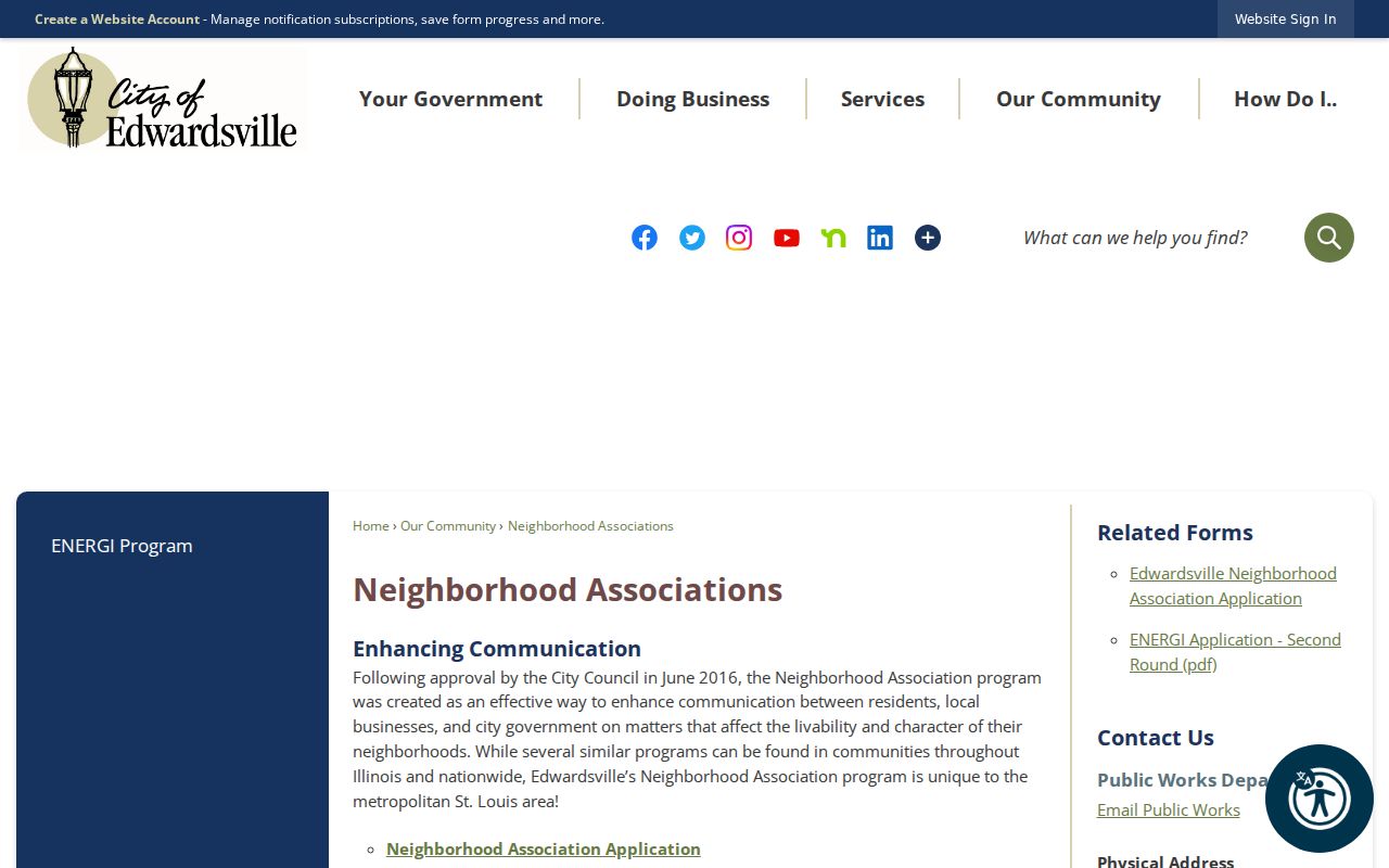
The page confirms a city-recognized contact network, not a countywide neighbor directory.
Archive Madison County Neighborhood Change
The Edwardsville Archive Center can add public-improvement and boundary context. Its search supports keywords, archive selection, time period, and date range. Minutes, ordinances, site plans, land-use matters, and city projects may explain a street change, annexation, sidewalk, drainage work, or public notice affecting the block.
The archive does not replace a parcel record. Start with a road, subdivision, project, or association name, then verify each property fact with DEVNET, a plat, or the responsible city office. Other Madison County municipalities maintain their own records, so address the request to the city where the parcel sits.
Open the Edwardsville municipal archive when a block needs dated city context.
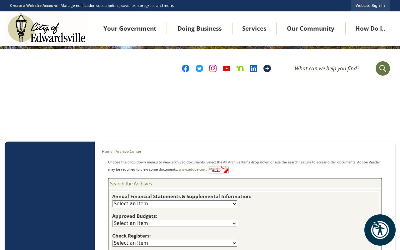
The date and archive filters help narrow a broad place name to the project or meeting tied to that block.
Historic Madison County Neighbors
For a past block, pair an old city directory with a Sanborn sheet and newspaper date. Hayner’s Alton directories begin with a listed 1858 volume and continue in incomplete runs. A street or address section may name listed households, while the person section can add a spouse or business line. The entry belongs to its publication year.
Sanborn sets for Alton include 1892, 1897, 1903, 1915/16, and 1926 editions. They supply street indexes, block and house numbers, building footprints, and use clues. Hayner newspapers and obituary files, Edwardsville Public Library’s Illinois Digital Archives, Madison Historical at SIUE, and the Madison County Historical Society can add names, photos, cemetery links, and civic memory.
Current and historic neighbors should never be merged without dates. A building can remain while a number, postal place, boundary, owner, or household changes. Alton, Upper Alton, North Alton, East Alton, Wood River, Fosterburg, Godfrey, and Leclaire may appear as distinct historical labels.
Official Madison County Neighbor Records
Official records and commercial neighbor tools answer different questions. The county sources identify the custodian, update frame, and legal meaning. Commercial profiles may blend public filings, stale addresses, phone links, and reseller data. They can join two same-name people or omit the date that gives a record meaning.
| Route | Strength | Limit |
|---|---|---|
| GIS and DEVNET | Parcel position and current assessment data | Owner is not every occupant |
| Recorder and plats | Recorded title and legal block | Search and copies may require several channels |
| Civic association and archive | Published boundaries, contacts, projects | No full household roster |
| Commercial compilation | May collect many leads | Context, dates, and accuracy can be weak |
Use the responsible county or city office when a fact matters. A public portal result is a lead until the parcel, instrument, or dated record is checked.
Protect Madison County Neighbors
Privacy sets a firm edge around a block lookup. Adjacent parcel owners may not occupy the parcel. Registered voters are not all household members. Utility customer and delivery records were not found as public county sources, and the federal Driver’s Privacy Protection Act restricts motor-vehicle address data. Sealed cases and nonpublic household details stay outside this search.
Illinois Safe at Home provides a substitute-address process for qualifying victims. It does not erase every old record, and property records are not guaranteed to be shielded. Never publish a substitute or protected address as if it were an ordinary current residence.
Lawful use. Look up Madison County neighbors for normal civic awareness and personal safety, never to watch, harass, threaten, or expose a person.
The Illinois State Police registry is a separate official safety source with its own notice and use rules.
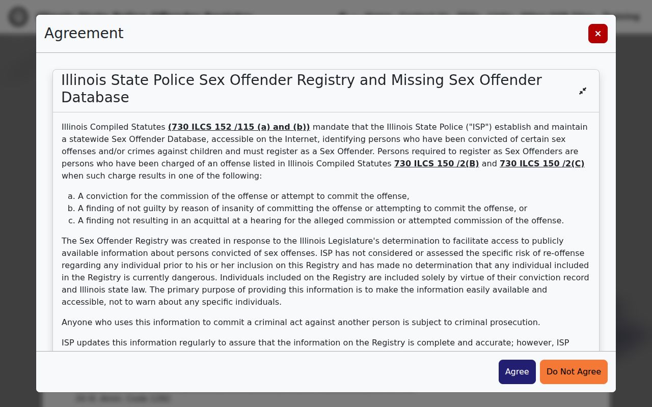
The registry’s warning screen reinforces that an official public record still carries strict limits on misuse.
The Madison County Sheriff publishes agency information and a phone route, but research did not locate a current public jail name-search interface.
Use the responsible agency for a specific public-safety question instead of inferring risk from an address or a neighbor’s name.